


OsmAnd — Maps & GPS Offline
4.53.18K Reviews
App Specs
- Version
- 5.3.10
- Updated On
- License
- Free
- Downloads
- 10,000,000+
- Developer
- OsmAnd
- Categories
- Travel & Local
- Platform
- Android, iOS
Screenshots

 Analysis by AppCompare
I value a navigation app most when it still helps after the signal drops, and OsmAnd — Maps & GPS Offline is built around that practical need. Its offline maps make it a strong option for exploring beyond dependable mobile coverage, while its many settings reward a little preparation. I find it more useful for people who like to plan their own routes than for someone who only wants the quickest, simplest directions across town.
Useful before you leave home
The key to a smooth trip is downloading the areas you need while you have a reliable connection. That turns an offline map from a backup into a real part of your plan: you can check the route and surrounding details without relying on mobile data once you set off. I would also look over the map before leaving, especially if the journey depends on a small trail or a less familiar road. Offline access is reassuring, but it does not replace a quick check that the map covers the places you intend to visit.
That preparation matters most on trips where reception is likely to be patchy, such as a countryside drive, a hike, or a visit to a place where roaming data is inconvenient. It also makes the app useful for people who prefer not to keep a connection active just to consult a map. The trade-off is that you need to think ahead: a map you have not downloaded will not be available offline simply because you have opened the app before.
Planning a route rather than just following one
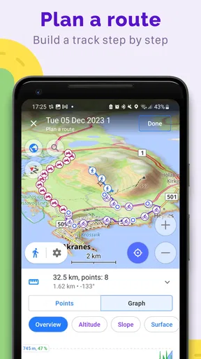
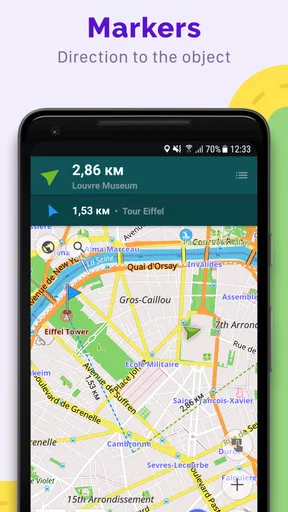
OsmAnd makes more sense when I treat navigation as something I can shape, not just a line chosen for me. The option to create routes and add waypoints is useful when the destination is only one part of the outing. For example, I might want to pass a trailhead, stop at a viewpoint, and then return by a different path. Building those stops into a route gives the trip a clearer structure than improvising each turn along the way.
For a practical everyday example, imagine driving to a rural guesthouse after work, with a planned walk the next morning. I would download the relevant map before leaving, use navigation for the drive, and then check the walking route while still somewhere with a dependable connection. That sequence reduces the chance of discovering too late that I have not prepared the map I need. It is a small habit, but it is more useful than assuming an offline app will take care of every detail automatically.
A different feel from mainstream navigation
Compared with the usual phone maps, OsmAnd feels more oriented toward detailed exploration and user-chosen routes than quick, hands-off directions. That distinction is a strength if you enjoy checking the map, adjusting what you see, and planning a journey with several stops. A mainstream navigation app can be more comfortable for a simple city trip where you just want to enter an address and follow the suggested route with minimal setup.
Neither approach is automatically better. I would keep a familiar general-purpose map handy for a routine commute or for quickly looking up a nearby business, while choosing OsmAnd when offline access, route planning, or outdoor travel matters more. If you switch between them, avoid assuming their maps or route suggestions will match exactly. It is sensible to review the route you intend to follow before setting off, rather than treating any navigation line as unquestionable.
Worth Reading Before You Choose

Flipboard Shows What News Apps Must Do Beyond the Feed

Switching to Android Auto Means Rethinking Your Driving Routine

Google Calendar Makes a Crowded Week Easier to Manage

Ludo King Makes the Most of the Minutes Between Plans

Baby Panda World Brings Quick Play to Modern Phones, but Its Game Library Feels Busy

ESPN’s Live Game View Makes Following Close Games Easier
Small decisions that improve an outdoor trip
Customization can help make a busy map easier to read, but it also invites tinkering. I would adjust the display for the kind of trip I am planning instead of turning on every available detail at once. A hiking map benefits from information that helps with terrain and route context; a drive through town may be clearer with less visual clutter. The useful question is not how many settings the app offers, but which ones help me make a decision at a glance.
When planning a walk, I would also set waypoints for meaningful decision points, not every minor bend. A waypoint at a junction or intended rest stop can make a custom route easier to follow without filling it with distractions. If the route changes, I would pause somewhere safe and check the map rather than trying to work through detailed settings while moving. This is especially important on a bike or on foot, where attention belongs on the road or trail.
Where the learning curve shows
The same flexibility that makes OsmAnd valuable can make it feel less immediate than a basic navigation app. If you have never planned a route or adjusted map details before, the number of choices may take some getting used to. I would not want to learn the controls in the middle of an unfamiliar hike. Spending a few minutes exploring the map and testing a route at home makes the first real outing less stressful.
Offline navigation also depends on sensible preparation and a charged phone. Downloading the map is only one part of being ready: I would check that the planned area is covered and keep a separate sense of direction rather than staring at the screen continuously. In remote places, a navigation app is a helpful tool, not a substitute for good judgment or other trip planning. That caution is not unique to OsmAnd, but it matters more when you are relying on a downloaded map far from familiar streets.
Who will get the most from it
I would recommend OsmAnd to hikers, cyclists, and travelers who want detailed maps available offline and are willing to prepare a little before setting out. It is also a good fit for people who like shaping a route around stops, rather than accepting the first suggested path. The ability to use it for driving, walking, and biking gives it a wider role than a map reserved for one kind of outing.
I would steer a different user toward a simpler alternative: someone who mainly needs quick directions to shops, live traffic-aware commuting, or the least complicated route interface. Likewise, if you dislike downloading maps and adjusting settings, OsmAnd may feel like more work than you want from a daily navigation tool. Its value is clearest when offline access and control are priorities, not when every trip is short and familiar.
OsmAnd is a free travel and local navigation app from OsmAnd, with a 4.5 average from around 234,000 ratings and over 10 million installs. It is rated for everyone, and its current version is 5.2.13. Optional in-app purchases range from about $1.63 to $69.99 per item, so I would check what is included before buying anything rather than assuming every extra is necessary. For me, the main appeal is the combination of downloadable maps and hands-on route planning, not a promise that every journey will be effortless.
Getting Started with OsmAnd
First things first, downloading OsmAnd is a breeze. It’s available on both Android and iOS, so no matter what device you're rocking, you’re covered. Once installed, you're greeted with a clean and intuitive interface. I appreciated how straightforward it is, making it easy to dive right in without any confusion.
Maps that Go Wherever You Go
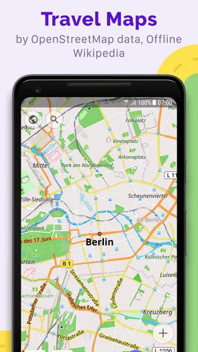
One of the standout features of OsmAnd is its ability to provide offline maps. Yep, you heard it right—no internet, no problem! You can download maps for specific regions and access them anytime, anywhere. I recently took a road trip through a remote area with spotty reception, and OsmAnd didn’t miss a beat. The maps were detailed, and I loved how it included everything from small trails to major highways.
Navigation and More
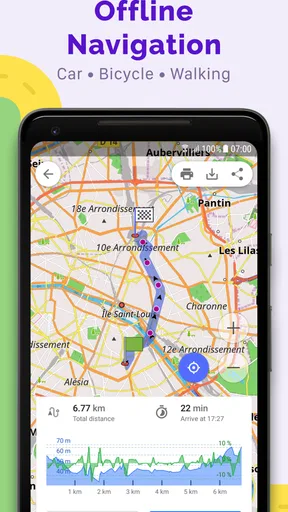
The navigation system in OsmAnd is pretty impressive. It offers turn-by-turn voice guidance, which is super handy when you’re navigating unfamiliar roads. What’s cool is that it also supports biking, walking, and even skiing routes. So, if you’re an outdoor enthusiast like me, this app has got you covered. There’s also a neat feature where you can set up your own routes and waypoints, which I found perfect for planning custom trips.
Customizable to Your Heart’s Content
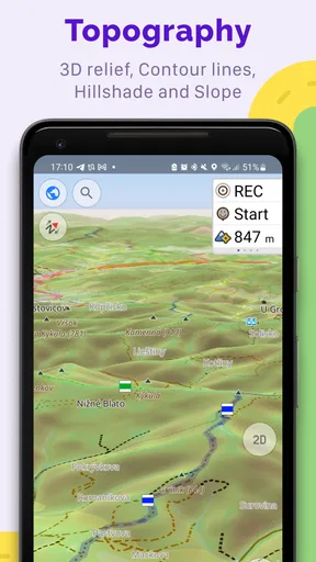
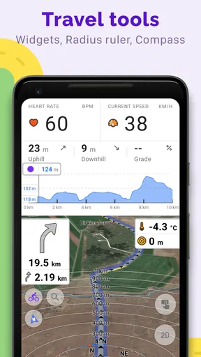
Now, let’s talk about customization. One of the things I love about OsmAnd is how customizable it is. You can tweak almost everything—from map details to the color scheme. I spent a good amount of time tailoring the app to my preferences, and it made the whole experience more personal and enjoyable. Plus, it supports plugins that add even more functionality, like contour lines and hillshades, which are great if you’re planning a hiking trip.
Community and Updates
OsmAnd thrives on its active community. The maps are updated regularly with the help of OpenStreetMap, so you’re always getting the latest information. I’ve noticed that the community is pretty responsive in fixing any map errors or adding new features. It’s reassuring to know that there’s a whole team of enthusiasts working to make the app better every day.
The Bottom Line
In conclusion, if you’re on the hunt for a reliable offline map app, OsmAnd should definitely be on your radar. It’s packed with features that cater to a variety of needs, whether you’re a casual traveler or an avid adventurer. Its offline capabilities, combined with robust navigation and customization options, make it a must-have tool in your travel arsenal. I’ve found it incredibly reliable and versatile, and I’m sure you will too. So go ahead, give it a spin and explore the world without boundaries!
Pros
- High customization options for maps.
- Offers offline routing and navigation.
- Frequent updates with new features.
- Supports a wide range of map sources.
- Extensive POI database included.
Cons
- Can be complex for new users.
- Occasional bugs in offline mode.
- High battery consumption reported.
- Map downloads can be large.
- Limited real-time traffic updates.
FAQs for OsmAnd — Maps & GPS Offline
What features does OsmAnd offer for offline navigation?
OsmAnd provides comprehensive offline navigation, allowing users to download and store detailed maps for use without an internet connection. It supports turn-by-turn directions, voice guidance, and real-time rerouting. Additionally, users can access points of interest, hiking and cycling routes, and topographic maps, making it highly versatile for offline travel.
How accurate are OsmAnd’s maps and GPS functionalities?
OsmAnd utilizes data from OpenStreetMap, which is known for its community-driven accuracy and regular updates. The app offers precise GPS tracking and detailed maps, which include elevation data and contour lines. While accuracy is generally reliable, users may occasionally find minor discrepancies depending on the region and data update frequency.
Is OsmAnd suitable for outdoor activities like hiking or biking?
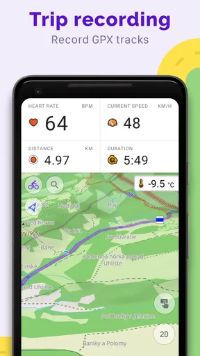
Yes, OsmAnd is particularly well-suited for outdoor enthusiasts. It offers specialized maps for hiking, biking, and other activities, complete with contours, elevation info, and routes. The app also supports GPX file imports, allowing users to follow pre-planned routes or share their own, enhancing its utility for outdoor adventures.
What customization options does OsmAnd provide?
OsmAnd is highly customizable, allowing users to tailor the interface and map views to their preferences. Users can adjust map styles, select which layers to display, and configure the navigation voice and language. The app also offers plugins for additional functionalities, such as nautical maps or ski data, ensuring a personalized user experience.
Are there any costs associated with using OsmAnd?
OsmAnd offers a free version with basic features and a limited number of offline map downloads. For more extensive use, there’s a paid version, OsmAnd+, which provides unlimited map downloads and additional features. Users can also purchase specific plugins to enhance functionality, making it a flexible choice based on individual needs.


